What is a Watershed?
Do You Live In a Watershed?
Of course, you do… we all do!
Watersheds are integral to the survival of our environment. A watershed is an area of land on which any water within it drains to a common point. That common point may be a lake, the outlet of a river, or any point within a river system. Just as when you pour water in a bathtub, it all ends up in the drain, when it rains on land, rainwater flows over land, farms, forests, and residential lawns to a particular body of water. Water can flow both above the ground through lakes, streams, and wetlands, or below the ground through groundwater and springs.
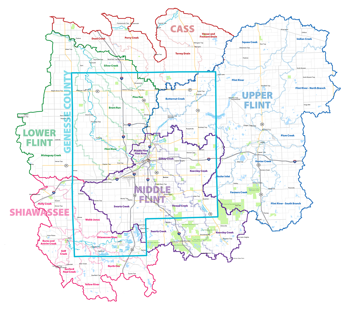
The Flint River Watershed covers most of Genesee County. There are two other major watersheds in Genesee County: the Shiawassee River Watershed and the Cass River Watershed. The Flint River Watershed along with the Shiawassee River Watershed and the Cass River Watershed all flow to Saginaw Bay. Visualize this process with the Saginaw Bay poster and the What Is Your Watershed Address poster.
The Upper Flint River Watershed encompasses the area that enters the Flint River upstream of the City of Flint.
The Middle Flint River Watershed enters the Flint River within the City of Flint’s boundaries while the Lower Flint River Watershed drains to the Flint River downstream of the City of Flint.
The two other major watersheds are the Shiawassee River Watershed in the southwest of the county and the Cass River Watershed in the North.
One watershed can be located within other watersheds. For example, there are four sub-watersheds that make up the Middle Flint River Watershed: the Swartz Creek, the Thread Creek, the Gilkey Creek, and the Kearsley Creek Watersheds. These sub-watersheds can be sub-divided even further. Although the Flint River watershed is very large it, along with other watersheds, come together to form the Saginaw Bay watershed. All the water in the Saginaw Bay Watershed eventually flows into Lake Huron at Saginaw Bay
Two different sets of watershed maps are provided. The first set illustrates the watersheds in general. The second set of maps is geared toward our School Districts and where the schools are located within the watersheds. Refer to the For Teachers page for additional resources.
General Watershed Maps
- Countywide Watershed
- Upper Flint River Watershed
- Middle Flint River
- Lower Flint River
- Shiawassee River
- Cass River
School Focused Watershed Maps